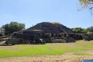
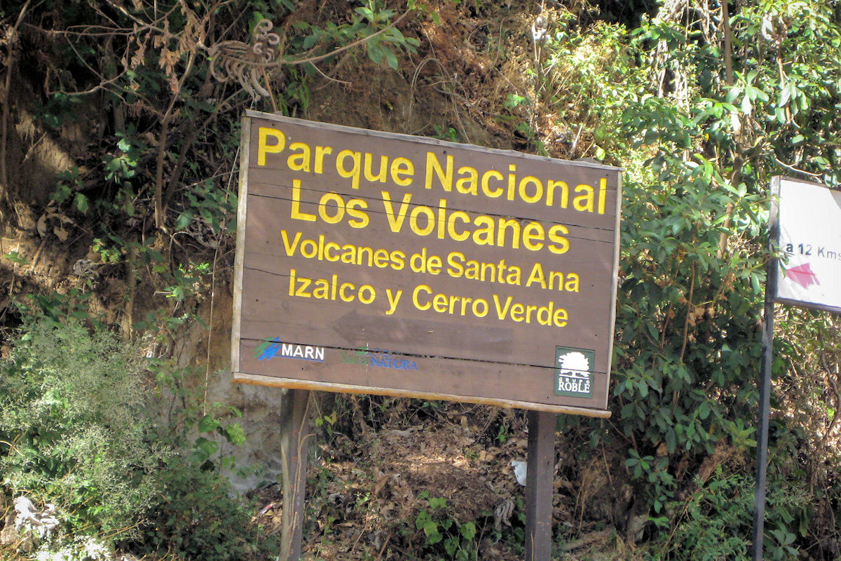
El Salvador has so much to offer that choosing between one tourist destination and another is a big task. An example is the imposing Volcanoes Route, where you can enjoy the view of 3 of the 14 volcanoes in the beautiful Cordillera de Apaneca-llamatepec.
This destination is composed entirely of the National Park Complex Volcanoes and has an area of about 4,500 hectares. It comprises state, private and municipal lands and impressive elevations ranging from 500 to 2,381 meters above sea level.
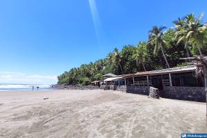
VOLCANOES ROUTE - Routes of El Salvador. Photo by ElSalvadorViajar.
In addition, the National Park has been endorsed by UNESCO since 2007 under the Conservation Zone and Biosphere Reserve of Apaneca-Llamatepec. The route is Cerro La Vieja y Chiflón, whose translation originates in the Náhuatl language.
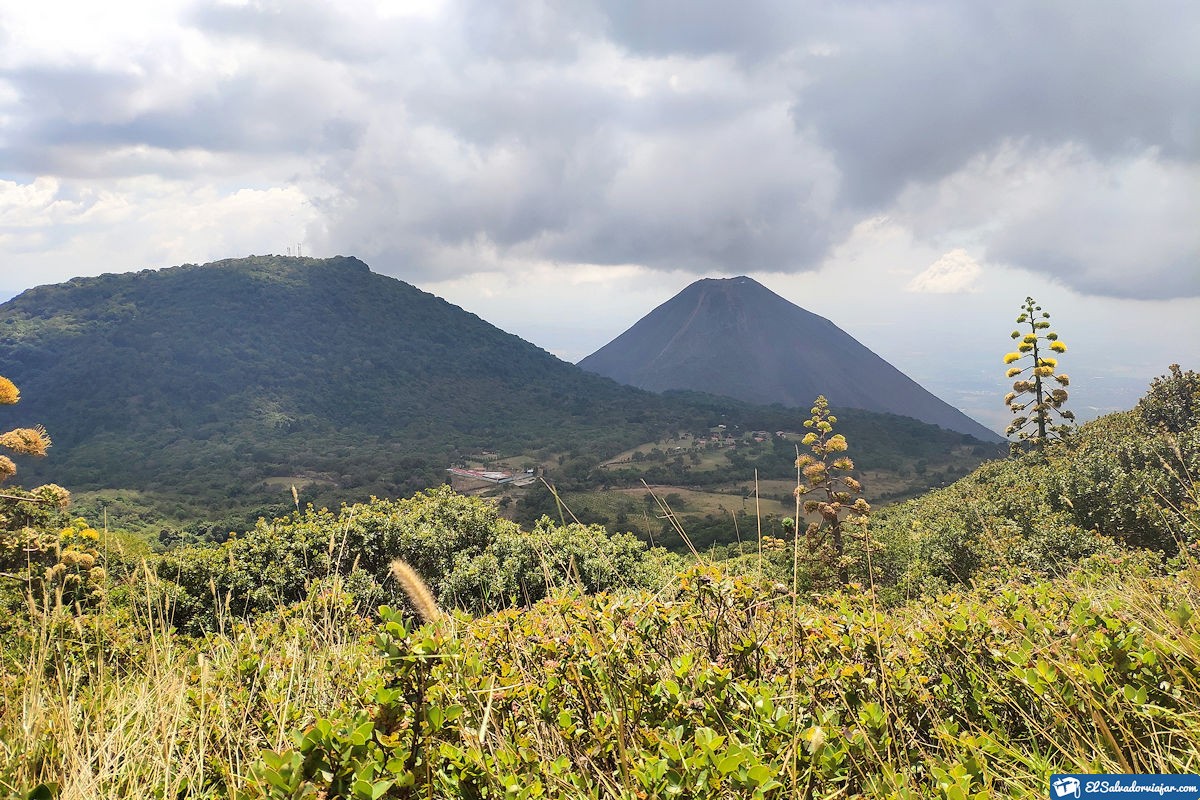
Its most relevant feature is the hydrogeology that characterizes the three volcanoes, Santa Ana, Cerro Verde, and Izalco. Located precisely in the departments of Santa Ana and Sonsonate and have a geological age between 2 million and 250 thousand years.
On the other hand, the largest volcano on the route is the Ilamatepec or Santa Ana, which last erupted in 2005. It is preceded by the Cerro Verde Volcano, which is more than 1.5 million years old and 2,030 meters above sea level, and its last eruption dates back 25 thousand years ago.
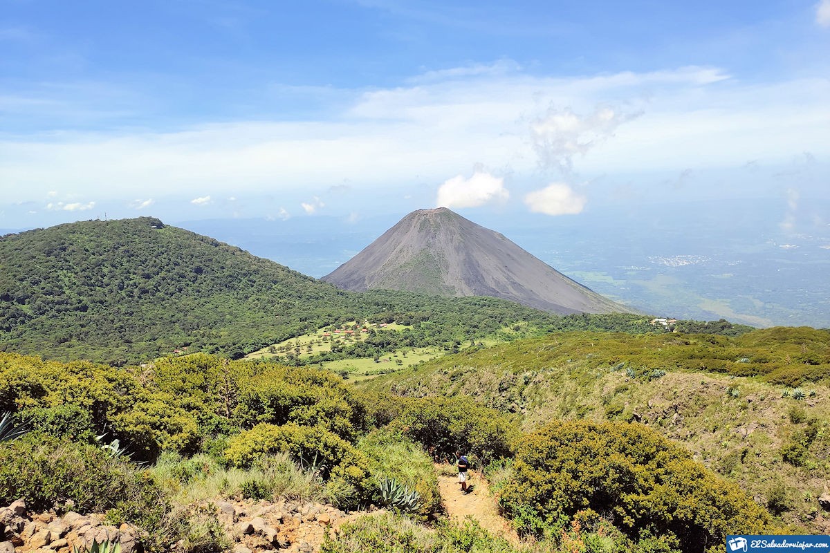
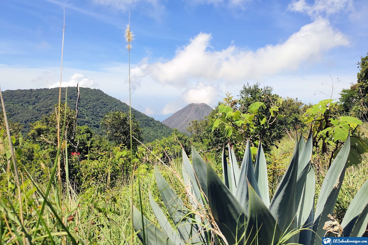
The third and last volcano is the Izalco, also known as the Lighthouse of the Pacific, as it served as a guide for decades for the ships that sailed the seas of El Salvador. Three outstanding natural monuments of El Salvador that we invite you to know.
What to see and do in El Salvador’s Volcanoes Route?
El Salvador is the smallest country in Central America, but this does not limit its beauty and natural wealth. Nor all the stories that worship their customs, traditions, and culture. So if you are one of those who love hiking outdoors, the National Park Complex Volcanoes has the ideal route for you.
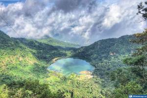
You can reach it through the road to Sonsonate in Cerro Verde, 67 km from San Salvador, or by the Panamerican Highway, 77 km. The latter surrounds the entire Coatepeque Lake. But this is not the most important thing.
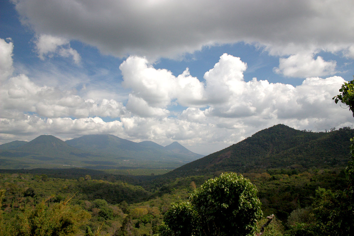
The entire tour is characterized by the area’s great animal and plant diversity that can see from different points. These are the peaks of the volcanoes, which enhance the view of the habitat and its surroundings.
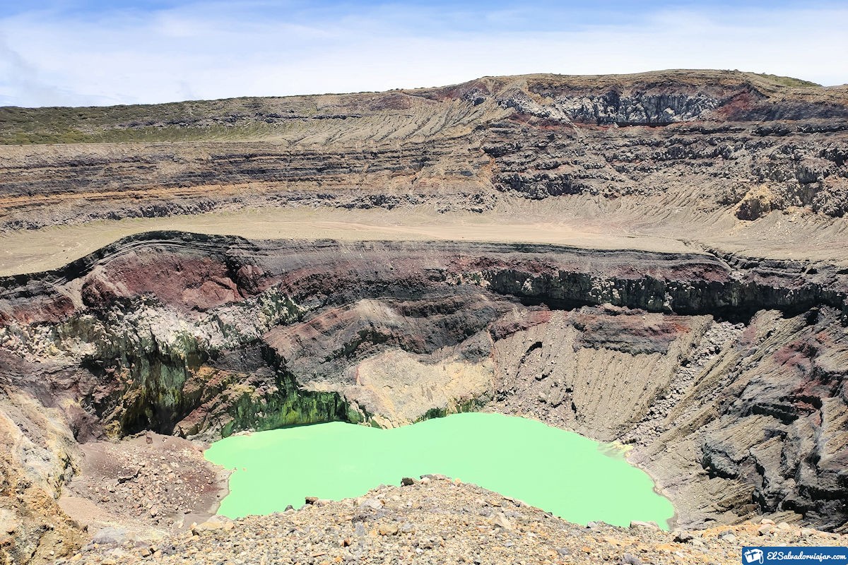
Part of the natural attractions of the Volcanoes Route of El Salvador is its cloud forests, moorlands, and many plants on lava. In addition to the sulfurous lagoon of the Santa Ana Volcano and many plantations.
It should be noted that there is a greater or lesser predominance of vegetation and fauna for each volcano due to soil conditions and volcanic activity. You can learn all the details below.
Volcanoes Route of El Salvador
Izalco or The Pacific Lighthouse
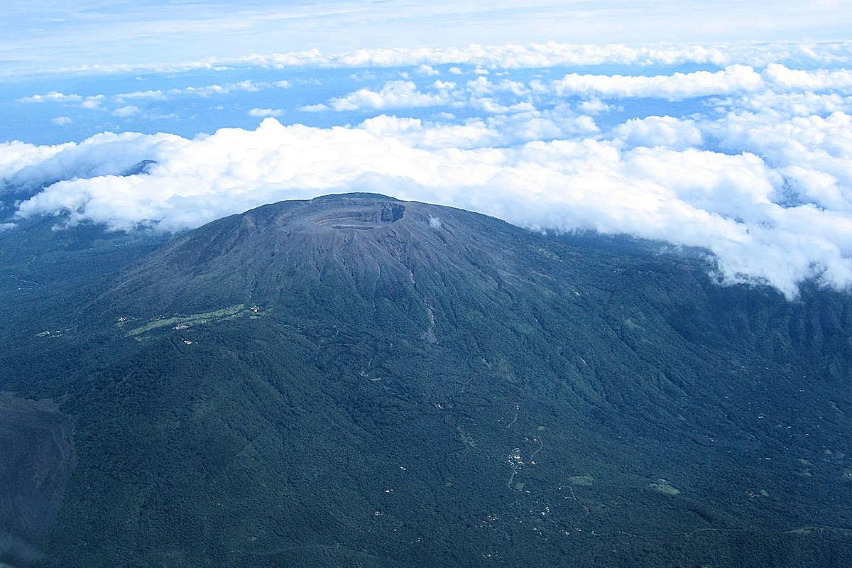
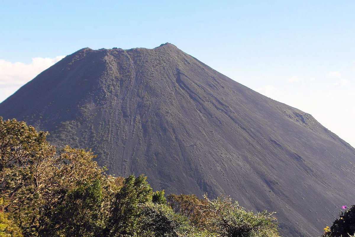
This is the youngest volcano in El Salvador and all of America. According to geologists and historians, its origin dates back to 1770. This year, opened a hole at the base of Ilamatepec, from which smoke and ashes came out.
However, other data indicate that its origin dates back to 1722, and it was not until 1745 that it erupted for the first time. The truth is that for more than 190 years, it had consecutive eruptions that could be seen from the Salvadoran sea, thus receiving the name of El Faro del Pacífico (The Pacific Lighthouse).
This is how the Izalco Volcano became a reference point for all ships passing by the country’s coasts. On the other hand, a cone of at least 650 m on the plain due to its volcanic activity. Its crater reached 250 m in diameter with a height of 1,952 meters above sea level.
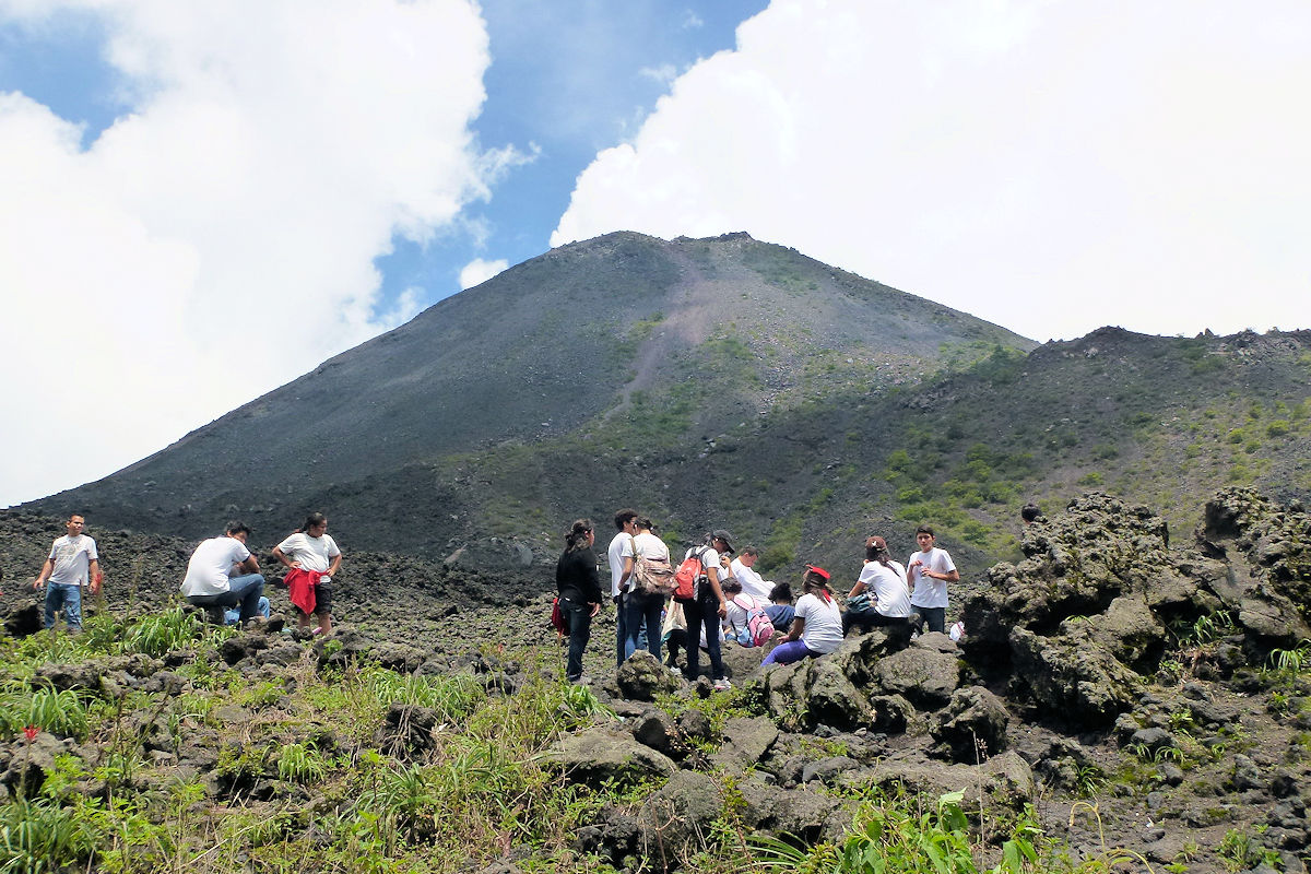
In 1958 its last major eruption was recorded, and after eight years, it woke up again with a small eruption. Since then, the volcano’s activity has decreased considerably.
Cerro Verde
Cerro Verde is an extinct volcano you can enjoy during the tour along the route. It has a height of 2030 meters above sea level, and according to research, its last eruption dates back to 25 thousand years B.C. Its size is such that it covers more than 2,700 hectares of the park.
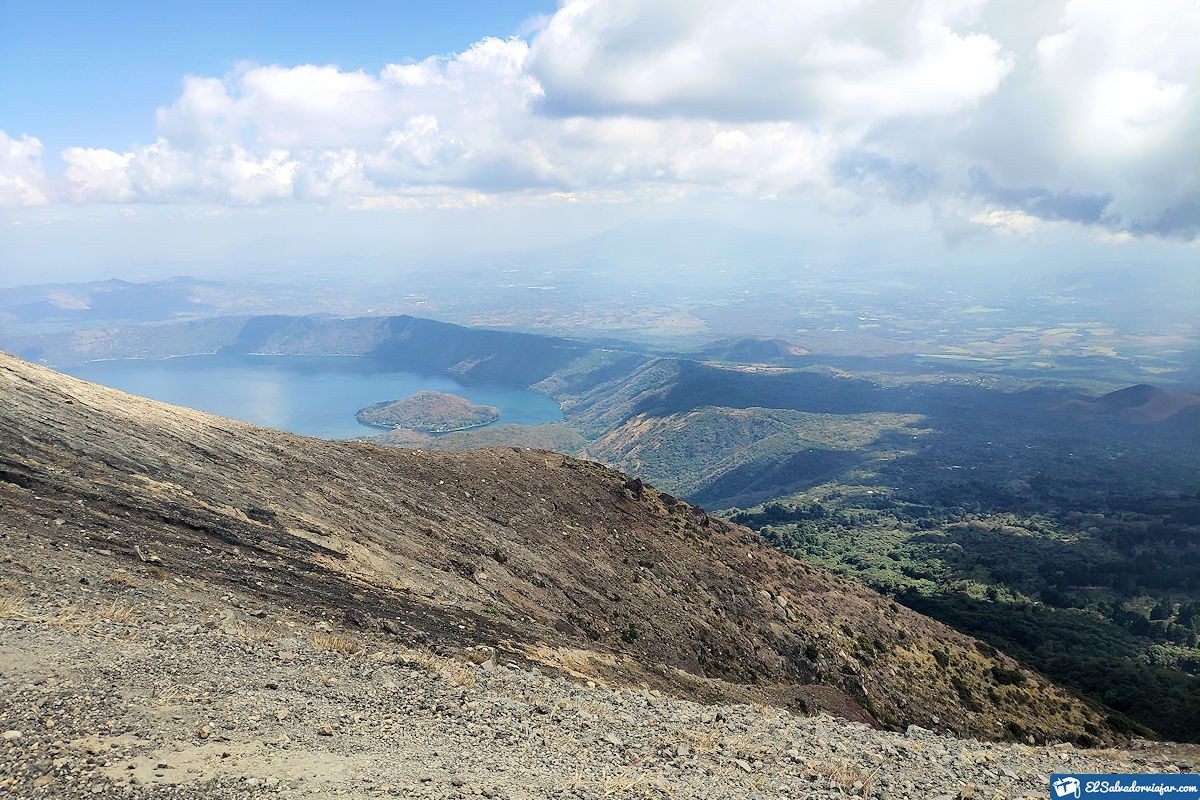
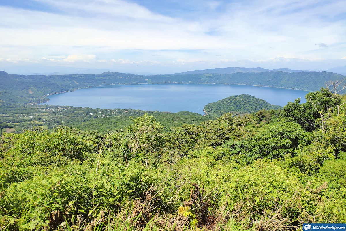
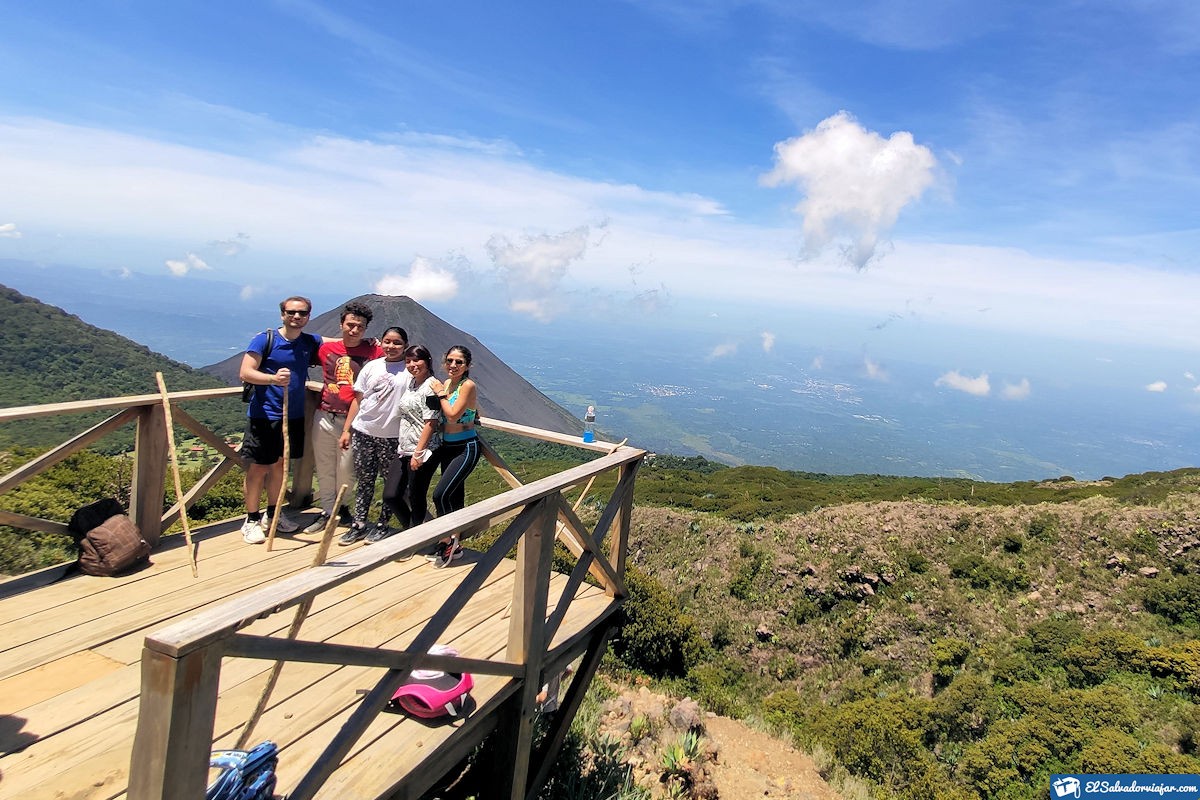
Within the volcano area, you can find viewpoints that make it possible to visualize its companions, the Izalco Volcano and the Santa Ana Volcano. In addition to Lake Coatepeque, an impressive orchid garden and trails through the cloud forest, Window to Nature, among others.
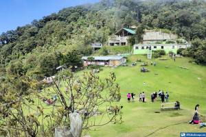
There are three direct access routes to Cerro Verde. First, there is the road to the volcano from Santa Ana, which is completely paved. Here you can count on the help of local guides, cafeteria service, and soon, a mountain hotel.
The second route is from the municipality of San Blas, 11 km from the road turnoff. This route has a park ranger station, cafeteria, and lodging services. In addition, you will find three direct trails to the volcanoes.
The last one is in the municipality of Los Andes, 8.4 km from the highway turnoff. Access by this road must be done in a 4×4 vehicle, as the road is dirt. There is also a park ranger station, dining room, and ecological lodge.
Ilamatepec or Santa Ana
To finish the Volcanoes Route, we have the imposing Santa Ana or Ilamatepec Volcano, whose height is 2,381 meters above sea level. Therefore, it is the highest summit in all of El Salvador. It is an active volcano, and due to its last eruptions in 1904, 1920, and 2005, it obtained the volcanic category 3. This volcano is at least 2 million years old and has always been active.
During colonization, this colossus was called Volcán de Los Izalcos, de Fuego, and Volcán de Sonsonate. Even Salvadoran historians assure that there is no record that the actual name of this is Ilamatepec in the Nahuatl language. The closest would be Lamatepec which means “Cerro Padre.”
On the other hand, due to its large size and dimensions, this volcano occupies part of some regions, such as San José Miramar, La Auxiliadora, San Blas, and Los Andes. Thanks to its extensions, it is possible to camp in the area with the authorization of the park rangers.
Unlike the other two volcanoes, Ilamatepec has two different routes. The first consists of a 6.9 km round trip. The hike starts from the road to Cerro Verde and then takes a detour to Santa Ana. You can enjoy the cloud forest, Lake Coatepeque, and two other volcanoes here.
The second option is the tourist route, consisting of a distance of 7.6 km and starting near the Casa de Cristal to the volcano trail. On the way, you will be able to appreciate the sulfur lagoon, the lake, and the other volcanoes.
Climate, Flora and Fauna
A cool climate characterizes the route to the Izalco Volcano. Between 16 and 20 °, C drops to 7 ° C in rainy seasons at night. However, temperatures can vary between 26 and 30 °C for the sunniest days of the year.
In the case of Cerro Verde Volcano and Ilamatepec Volcano, the average temperature is between 6 and 8 °C, while for the sunniest days, the average is 16 to 24 °C.
Given these climatic conditions, the three volcanoes can harbor a great diversity of flora and fauna. In the case of flora, this park area has more than 125 tree species distributed in a tropical forest, the paramo, and a lava flow zone with little vegetation.
Therefore, among these species are abundant pinabete, sapuyulo, lycopods, and grasses. Also, you can see different types of orchids, bromeliads, and more than 134 hectares of cypresses. As for the fauna, the species that stand out the most are mammals and birds.
Some examples are coyotes, deer, and ocelots. As for birds, you can find the short-tailed hawk, the mountain hawk, and the black eagle. Can be observed all this natural wealth in a complete tour that varies according to the volcano.
Visiting Tips
The natural riches of El Salvador are unparalleled, and being able to see them is, without a doubt, something unprecedented. The majesty of each of its volcanoes is the best example of this. So if you want to do the Volcanoes Route and have a great experience, you must know some of the park’s rules. For example:
- The Volcanoes National Park does not allow tourists to enter the park with firearms, alcoholic beverages, or narcotics.
- All visitors must register before entering the park and must surrender all firearms at the entrance booth at the time of registration.
- Campfires may be held on the campgrounds.
- All hikes must be in company by a guide, a park ranger, or a member of the police.
- Tourists with their pets are not allowed.
- If you use some roads to reach the park in a private vehicle, you may not drive faster than 10 km/h.
- Every one of these rules has been established to protect tourists’ safety and conserve the habitat in its natural state. Therefore, depending on the access routes, you may be unable to camp.
Every one of these rules has been established to protect tourists’ safety and conserve the habitat in its natural state. Therefore, depending on the access routes, you may be unable to camp.
Other recommendations: Schedules and prices
If you want to live an unforgettable experience with your family or friends, the opening hours of Complejo Los Volcanes National Park are from 8:00 am to 4:00 pm. Also, being a space that involves private and public areas, you must pay for access to the park.
Ticket prices are as follows:
- Izalco Volcano: $1.5 Salvadoran; $3 foreigners; free admission for children under six years old and senior citizens.
- Santa Ana Volcano: $1.5 Salvadoran, $3 foreigners, free for children between 0 and 6 years old and adults over 60.
- Cerro Verde: $1.5 Salvadoran, $3 foreigners, children under six years old, and senior citizens are free.
Cerro Verde has a parking area for tourists, educational institutions, and excursions. Should note that this is the only park area that offers this service, so it also has a price per use. These are:
- Light vehicle: $1.
- Heavy vehicle: $3.
On the other hand, each route to the volcanoes is different and is measured in levels of complexity for hiking. For example, Cerro Verde is Known as a simple route ideal for all levels and ages.
In the case of Santa Ana and Izalco, the level is moderate, with a steep last stretch and ascent of 5/10 and 6/10. Izalco is the most complex. In addition to this, it is important to consider the terrain conditions, but above all, the weather conditions.
Therefore, it is recommended to bring the following:
- Sunscreen.
- 1.5 liters of water for each route.
- Cap or hat and sunglasses.
- Comfortable and warm clothes, depending on the season of the year.
- Comfortable mountain shoes.
- Refrain from camping between May and October when rainfall is more frequent, and the temperature drops to 7°C.
In addition, we recommend nearby places to visit:
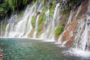
The town of Izalco is very picturesque; you can go to eat, take a walk, visit its churches, or also approach the Atecozol spa and enjoy its spring waters and all its vegetation. On the side of Santa Ana, you can go to Lake Coatepeque with stunning views, which will surely relax you, especially at the end of the hike to the volcano’s crater.
Without further ado, we wish you success in your ecological adventure through the Volcanoes Route of El Salvador. A route that will take you to know a great diversity of fauna and flora, highlighting plant species that do not exist anywhere else in the world and that you can enjoy here.